
Doral is right on Miami International's doorstep, which puts much of it under Class B airspace - the most restrictive category there is. It also puts it at the center of Miami-Dade's logistics economy.
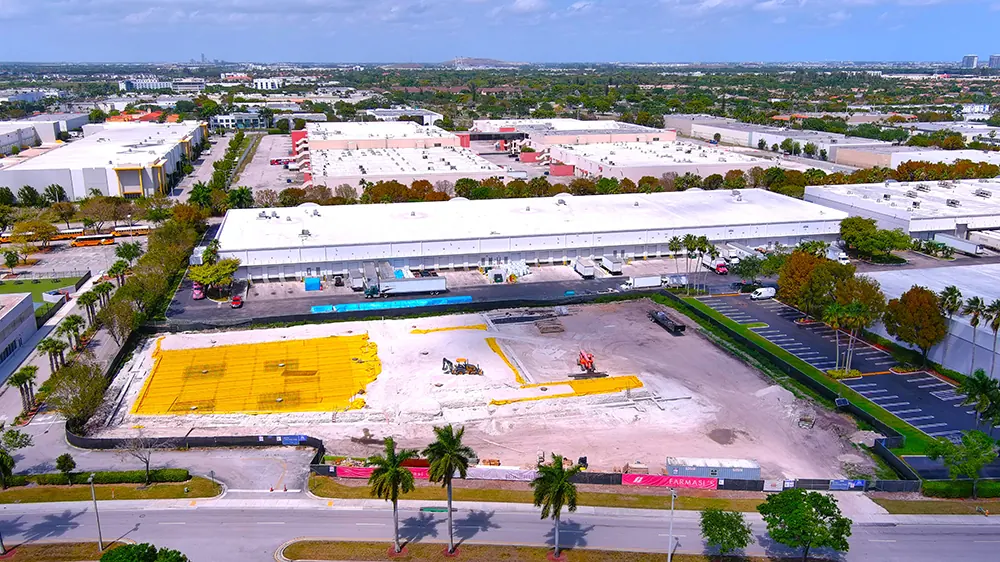
That combination produces a very specific kind of work. Doral is warehouses, distribution centers and business parks, which means large flat roofs, large parking fields and large sites - all of which are far cheaper to document from the air than on foot.
It is our strongest orthomosaic market outside construction: a measured, geo-referenced map of a distribution site is a genuinely useful asset for facilities planning.
Doral sits immediately west of Miami International, so Class B airspace covers a substantial part of the city. We hold FAA Part 107 certification and file for the authorizations those shelves require, which is work you never have to see — but it is why an address here wants a few days of notice rather than a few hours.
What we shoot in Doral
- Industrial and warehouse roof documentation
- Distribution and logistics site records
- Orthomosaic maps of large flat sites
- Business park and commercial leasing photography
- Construction progression on industrial builds
Doral neighborhoods we fly
Not a boundary, just the addresses we see most. If yours is not here, call anyway — it is usually still a yes.
- Doral
- Downtown Doral
- Doral Isles
- Sabal Chase
- Airport West
- Beacon Lakes
- Grand Bay
Flying in Doral
Can you fly in Doral, right next to Miami International?
With authorization. Class B airspace covers much of the city, which means a filing and lead time on every commercial flight. It is normal work, but it is not same-day work.
Why document a warehouse roof from the air?
Because it is acres of flat roof. Walking it is slow, and an aerial set gives you the whole envelope in one pass and a dated record to compare against next year.
What is an orthomosaic and do I need one?
It is a measured, geo-referenced map built from many overlapping aerial frames. On a large flat site it is far more useful than photographs, because you can measure off it.
Do you do industrial construction progression?
Yes, on the same repeatable-waypoint basis as vertical construction.
We fly next door too
Miami-Dade County and the rest of South Florida, from the same base.
Before you book
Tell us the address. We will handle the sky.
Same business day quotes, FAA-certified pilots, and edited stills back within 24 hours of the shoot.