
Davie is acreage. Ranch parcels, equestrian property, paddocks and land listings - the kind of property where a ground photograph is close to useless because the thing being sold is the shape and size of the ground itself.
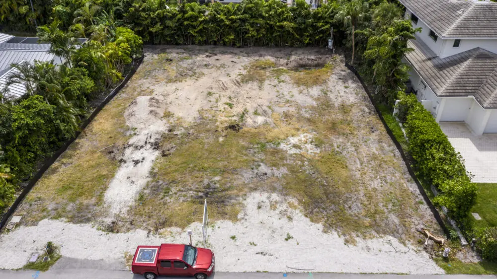
An aerial frame from the right altitude shows the whole parcel, its boundaries, its access, its outbuildings and what sits on the other side of the fence. On a land listing that is not a nice extra, it is the listing.
The town also carries the South Florida Education Center campuses, which generate institutional documentation work of a kind we do not see elsewhere in Broward.
Fort Lauderdale Executive (FXE) to the north and North Perry (HWO) to the south both reach into Davie, so much of the town sits in controlled airspace. We hold FAA Part 107 certification and file for the authorizations those shelves require, which is work you never have to see — but it is why an address here wants a few days of notice rather than a few hours.
What we shoot in Davie
- Acreage and land listings with boundaries and access visible
- Equestrian property - paddocks, barns, arenas and the whole parcel in one frame
- Campus and institutional site documentation
- Vacant-lot marketing for developers and land brokers
- Pre-construction site records before ground is broken
Davie neighborhoods we fly
Not a boundary, just the addresses we see most. If yours is not here, call anyway — it is usually still a yes.
- Davie
- Cooper City line
- Long Lake Ranches
- Forest Ridge
- Rolling Hills
- Shenandoah
- Sunshine Ranches border
- Pine Island Ridge
Flying in Davie
Why does acreage need aerial photography?
Because the product is the land. A ground photograph shows a fence and some grass. One frame from altitude shows the parcel shape, the boundaries, the access and the outbuildings - which is what a buyer is actually deciding on.
Can you show property boundaries?
We can show the parcel and its context clearly enough for marketing. A drone photograph is not a survey and we will not present it as one.
Do you shoot equestrian property?
Yes - paddocks, barns, arenas and the full parcel, which is the set that sells a horse property.
Is Davie inside controlled airspace?
Much of it. Executive reaches in from the north and North Perry from the south.
We fly next door too
Broward County and the rest of South Florida, from the same base.
Before you book
Tell us the address. We will handle the sky.
Same business day quotes, FAA-certified pilots, and edited stills back within 24 hours of the shoot.